Yingjing Huang

PhD @ Peking University
Hi, I am Yingjing Huang (黄颖菁). 👋
I am an incoming University Assistant Postdoc at the University of Vienna. I hold a Ph.D. in Geographic Information Science from Peking University, China, where I was advised by Prof. Lun Wu (邬伦), Prof. Yu Liu (刘瑜), and Prof. Fan Zhang (张帆). During my doctoral studies, I also spent one year as a visiting researcher at the MIT Senseable City Lab, working with Prof. Carlo Ratti, Dr. Fábio Duarte, and Dr. Simone Mora. I received my B.S. and M.S. degrees from Wuhan University under the supervision of Prof. Teng Fei (费腾).
My research stands at the intersection of GIScience and Computer Vision. I focus on Urban Visual Intelligence, developing deep learning methods to analyze urban physical environments and their interactions with human activities.
news
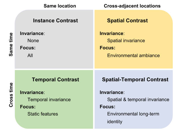
| Dec 13, 2025 | Our paper on “Learning street view representations based on a spatiotemporal contrastive learning framework” is accepted to Computers, Environment and Urban Systems 🎉🎉 |
|---|---|
| Nov 04, 2025 | I am honored to receive the DAAD AI-Net Postdoc Fellowship 😁😁 |
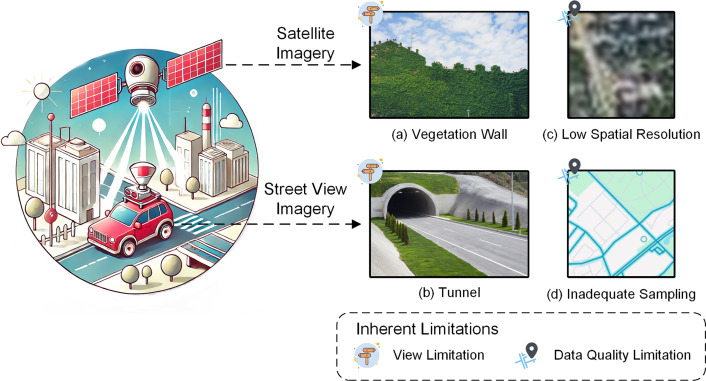
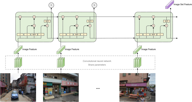
| Sep 16, 2025 | Our paper on “Representation learning for geospatial data” is accepted to Annals of GIS 🎉🎉 |
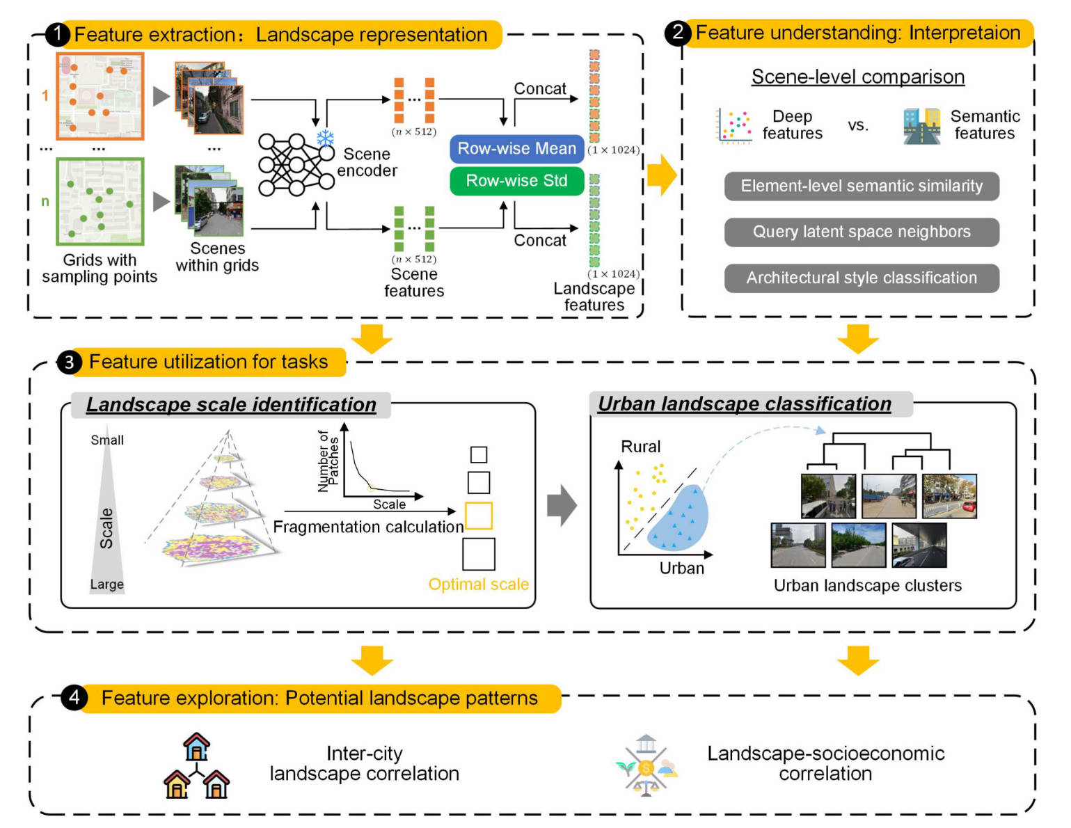
| Jun 18, 2025 | Our paper on “Measuring Urban Physical Environments Using lmage Deep Features: A Case Study” is accepted to Cities 🎉🎉 |
| May 19, 2025 | I successfully defended my PhD thesis! |